Drinking Water and Wastewater Systems Mapping

Training Outline
Accurate mapping is essential for operating, maintaining, and improving water and wastewater systems. This course introduces the types of maps used in the field, how to read and interpret them, and how GIS tools support asset management and real-time updates. Learn how to avoid common mapping errors and use field data to keep your system information accurate.
- Placement test1
Drinking Water and Wastewater Systems Mapping
- Importance of Mapping in Drinking Water and Wastewater Systems
- Geographic North, Scale, and Elevation
- Types of Maps Used in Drinking Water and Wastewater Systems
- How to Read Drinking Water Distribution System Maps
- How to Read Wastewater Collection System Maps
- Profile Drawing
- Geographic Information System (GIS)
- Field Data Collection and Mapping Updates
- Common Mapping Errors and Troubleshooting
Chapter test - 2Chapter test
- 3Chapter test
- 4Chapter test
- 5Chapter test
- 6Chapter test
- 7Chapter test
- 8Chapter test
Learning outcomes
- Explain the importance of mapping in drinking water and wastewater systems
- Identify the different types of maps used in drinking water and wastewater systems
- Describe the role of Geographic Information Systems
Level
Basic
Prerequisites
None
Target audience
Professional certified drinking water and wastewater operators class I to IV, maintenance technicians
Learning material and method
Video clips with placement test, practice exercises and handout
Learning assessment method
Chapter tests (MCQs) with a minimum score of 70%
Watch a Preview of the Course!
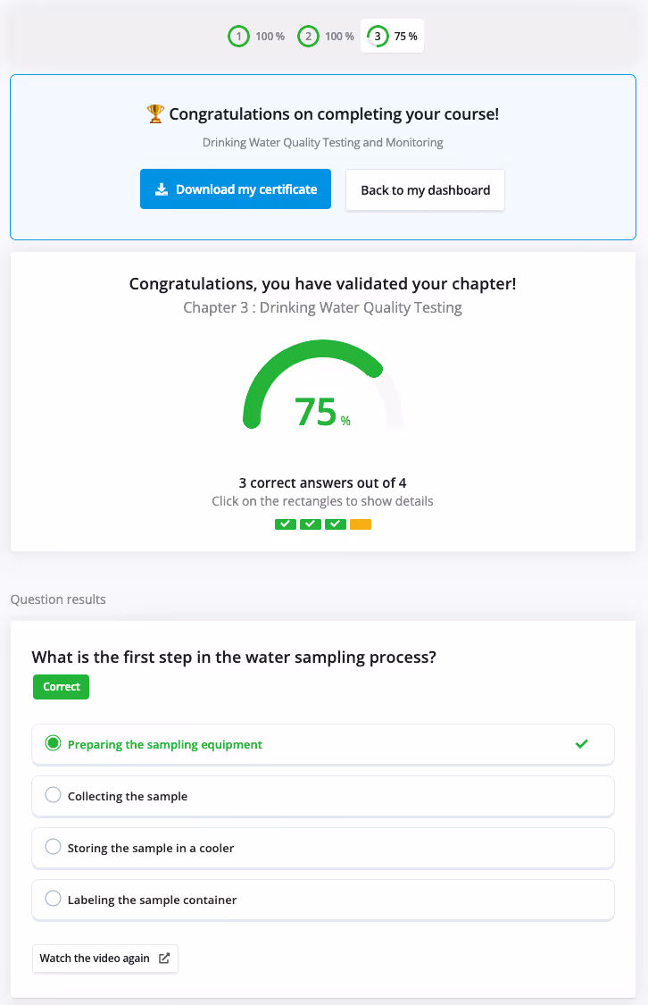
Test your knowledge, validate your skills
Engage with interactive quizzes designed to boost retention and track your learning along the way. Once you've completed the training, a final validation step confirms your progress and helps demonstrate your skills with confidence—making it easy to showcase what you’ve learned.
Frequently Asked Questions
Get clear answers to questions about our online training solutions for water and wastewater operators. Learn about course approvals, CEU requirements, platform access, and more, all in one place.
Taking a course with Watura is simple and flexible.
Just subscribe to our online training platform, create your account, and choose any course that fits your needs. You can start learning immediately.
Subscribing to Watura gives you unlimited access to all our courses and exam prep modules.
We provide custom support if you need help on the platform.
With our credit meter you can follow the advancement of your training renewal requirements.
You can earn CEUs/contact hours easily by taking any courses approved by your State's department.
Check the list of pre-approved courses for your State on our catalog.
YES! Before adopting Watura as your training solution, you can create a FREE account.
With this free access you can explore the platform, the course catalog, take placement tests, and watch the first video of each course.